From Wikipedia, the free encyclopedia
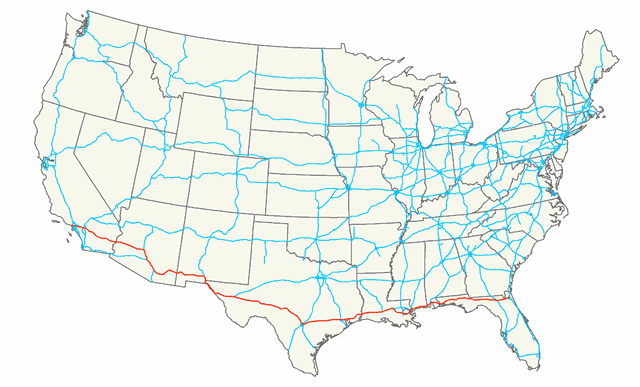
Interstate 10 (I-10) is the southernmost cross-country highway in the American Interstate Highway System. I-10 is the fourth-longest Interstate in the United States at 2,460.34 miles (3,959.53 km), following I-90, I-80, and I-40. This freeway is part of the originally planned network that was laid out in 1956, and its last section was completed in 1990.
I-10 stretches from the Pacific Ocean at State Route 1 (SR 1, Pacific Coast Highway) in Santa Monica, California, to I-95 in Jacksonville, Florida. Major cities connected by I-10 include (from west to east) Los Angeles, Phoenix, Tucson, El Paso, San Antonio, Houston, Baton Rouge, New Orleans, Gulfport, Mobile, Tallahassee, and Jacksonville. About one-third of its length is within the state of Texas, where the freeway spans the state at its widest breadth....
I-10 States/Provinces
This highway passes through multiple states or provinces. Each is broken out sepeperatly in these listings.
