
Interstate 25 Summary
From Wikipedia, the free encyclopedia
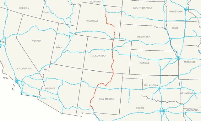
Interstate 25 (I-25) is a major Interstate Highway in the western United States. It is primarily a north\south highway, serving as the main route through New Mexico, Colorado, and Wyoming. I-25 stretches from Interstate 10 at Las Cruces, New Mexico (approximately 25 miles (40 km) north of El Paso, Texas), to Interstate 90 in Buffalo, Wyoming (approximately 60 miles (97 km) south of the Montana\Wyoming border). It passes through or near Albuquerque, New Mexico; Colorado Springs, Colorado; Denver, Colorado; and Cheyenne, Wyoming. The I-25 corridor is mainly rural, especially in Wyoming, excluding the Albuquerque, Pueblo, Colorado Springs, and Denver areas.
The part of I-25 in Colorado passes just east of the Front Range of the Rocky Mountains. That stretch was involved in a large-scale renovation named the Transportation Expansion Project (TRansportation EXpansion) in Denver, and the COSMIX (Colorado Springs Metropolitan Interstate Expansion). These projects and others in New Mexico were necessary because these stretches of I-25 were originally inadequately designed and constructed (the pavement was deteriorating rapidly), and also because urban areas like Albuquerque, Colorado Springs, and Denver had tripled and quadrupled in population much earlier than anyone had anticipated back in the 1950s and 1960s. Major highway work for the T-REX project ended on August 22, 2006. The COSMIX project was completed in December 2007. Several other smaller improvement projects for I-25 are still ongoing within New Mexico and Colorado....
I-25 States/Provinces
This highway passes through multiple states or provinces. Each is broken out sepeperatly in these listings.