
Interstate 29 Summary
From Wikipedia, the free encyclopedia
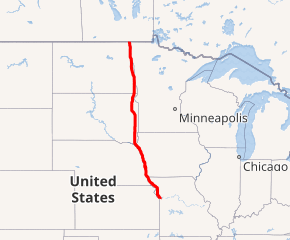
Interstate 29 (I-29) is an Interstate Highway in the Midwestern United States. I-29 runs from Kansas City, Missouri, at a junction with Interstate 35 and Interstate 70, to the Canada\US border near Pembina, North Dakota, where it connects with Manitoba Highway 75.
The road follows the course of three major rivers, all of which form the borders of U.S. states. The southern portion of I-29 closely parallels the Missouri River from Kansas City northward to Sioux City, Iowa, where it crosses and then parallels the Big Sioux River. For the northern third of the highway, it closely follows the Red River of the North. The major cities that I-29 connects to includes (from south to north) Council Bluffs, Iowa; Sioux Falls, South Dakota; and Fargo, North Dakota....
I-29 States/Provinces
This highway passes through multiple states or provinces. Each is broken out sepeperatly in these listings.