
Interstate 74 in Indiana
From Wikipedia, the free encyclopedia
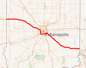
Interstate 74 (I-74) in the U.S. state of Indiana traverses central parts of the state from west to east. It connects Champaign, Illinois, with Indianapolis in the center of the state, and Indianapolis with Cincinnati, Ohio. I-74 covers 171.54 miles (276.07 km) across Indiana, a portion of which is concurrently routed through Indianapolis along the southern and western legs of I-465....
Full Wikipedia TopicI-74 IN Exits
Highway I-74 runs West to East with exit numbers starting at the western most exit of each state or province.
Lodging Fuel Food Vehicle Shopping Entertainment/Tourist Medical Assistance Police Fire Pets Bank/ATM