
Interstate 95 in Connecticut
From Wikipedia, the free encyclopedia
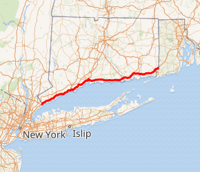
Interstate 95 (I-95) is the main north\south Interstate Highway on the East Coast of the United States, running in a general east\west compass direction for 111.57 miles (179.55 km) in Connecticut, from the New York state line to the Rhode Island state line. I-95 from Greenwich to East Lyme is part of the Connecticut Turnpike, during which it passes through the major cities of Stamford, Bridgeport, and New Haven. After leaving the turnpike in East Lyme, I-95 is known as the Jewish War Veterans Memorial Highway and passes through New London, Groton, and Mystic, before exiting the state through North Stonington at the Rhode Island border....
Full Wikipedia TopicI-95 CT Exits
Highway I-95 runs South to North with exit numbers starting at the southern most exit of each state or province.
Lodging Fuel Food Vehicle Shopping Entertainment/Tourist Medical Assistance Police Fire Pets Bank/ATM